import requests
import pandas as pd
import streamlit as st
import folium
from streamlit_folium import st_folium
st.set_page_config(layout="wide")
st.title("🌍 Aplikacja pogodowa")
def pobierz_pogode(lat: str, lon: str) -> dict:
url = "https://api.open-meteo.com/v1/forecast"
querystring = {
"latitude": lat,
"longitude": lon,
"past_days": "20",
"hourly": "temperature_2m,relative_humidity_2m,wind_speed_10m"
}
response = requests.get(url, params=querystring)
return response.json()
# Sekcja z mapą i współrzędnymi geo i info, że trzeba kliknąć
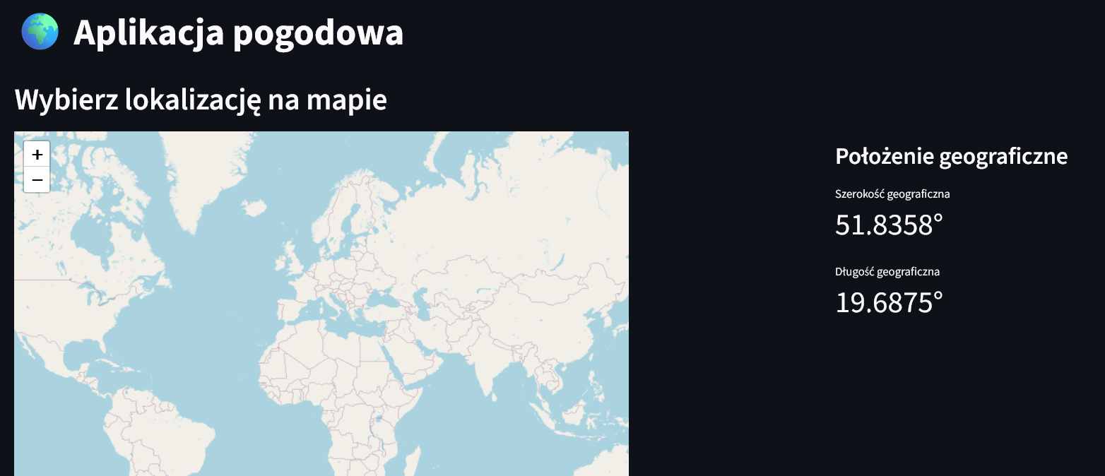
st.header("Wybierz lokalizację na mapie")
col1, col2 = st.columns([2, 1])
with col1:
m = folium.Map(location=[39.949610, -75.150282], zoom_start=2)
mapka = st_folium(m, width=725, height=500)
with col2:
if mapka and mapka.get("last_clicked"):
lat = mapka["last_clicked"]["lat"]
lon = mapka["last_clicked"]["lng"]
st.subheader("Położenie geograficzne")
st.metric("Szerokość geograficzna", f"{lat:.4f}°")
st.metric("Długość geograficzna", f"{lon:.4f}°")
else:
st.info("👆 Kliknij na mapę, aby wybrać lokalizację")
# Sekcja z danymi pogodowymi
if mapka and mapka.get("last_clicked"):
lat = mapka["last_clicked"]["lat"]
lon = mapka["last_clicked"]["lng"]
with st.spinner('Pobieranie danych pogodowych...'):
pogoda = pobierz_pogode(f"{lat:.2f}", f"{lon:.2f}")
pogoda_df = pd.DataFrame(pogoda["hourly"])
jednostki = pogoda["hourly_units"]
st.divider()
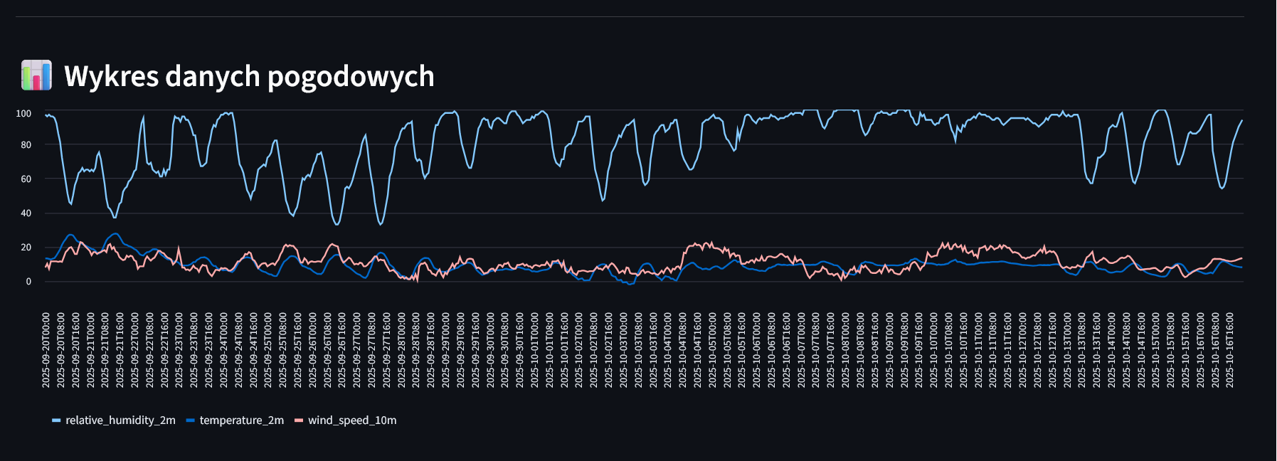
# Wykresik
st.header("📊 Wykres danych pogodowych")
st.line_chart(pogoda_df.set_index("time"), height=400)
st.divider()
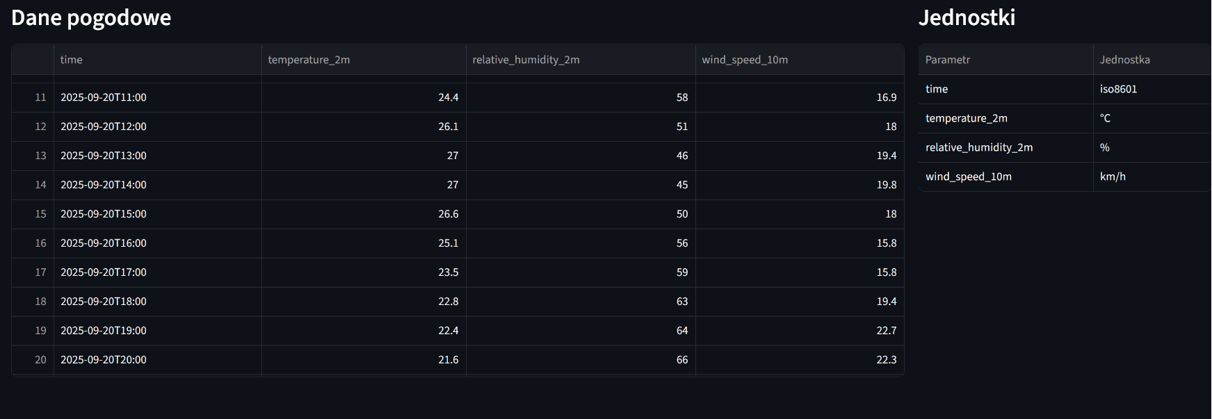
# Dane pogodowe i jednostki w tabelkach
col3, col4 = st.columns([3, 1])
with col3:
st.subheader("Dane pogodowe")
st.dataframe(pogoda_df, height=400, use_container_width=True)
with col4:
st.subheader("Jednostki")
jednostki_df = pd.DataFrame(list(jednostki.items()), columns=['Parametr', 'Jednostka'])
st.dataframe(jednostki_df, hide_index=True, use_container_width=True)